ArcGIS Pro Overview
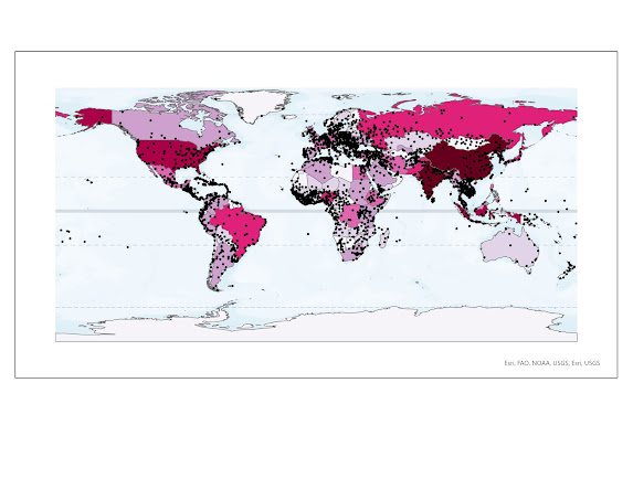
In our very first lab for GIS5050- Geographic Information Systems, we were tasked with familiarizing ourselves with introductory data management, ArcGIS Pro, and ArcGIS Help. To demonstrate our new knowledge, we had to set up a virtual machine with the proper files for importing and exporting documents, create and share our own map using ArcGIS Pro, and make several definitions using ArcGIS Help. Below is my first completed map! I chose a continuous color scheme with 7 classes to represent population. The darker the color, the more people live in that country. My map could benefit with a key since I do not think it is obvious what this map is trying to portray. The black dots represent cities. However, the representation here is also nebulous. It is unclear if these cities are similar in population size or how they relate to a country's overall population. I noticed we also used a Mercator map, which distorts landmass at the higher latitudes. Overall, I am feeling more confident i...