Posts

Showing posts with the label GIS4035

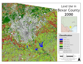
Land Cover / Land Use Change Analysis of Bexar, Texas from 2000-2020

Image
 

Unsupervised & Supervised Classification

Image
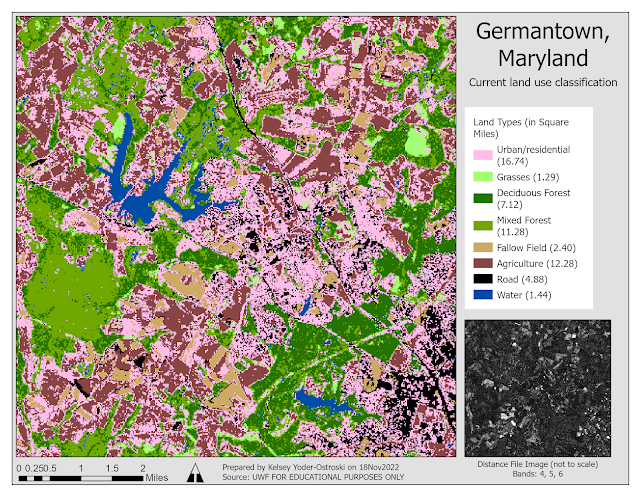
For this week in GIS4035, we learned about unsupervised and supervised classification using ERDAS Imagine.  The included map is my supervised classification product of Germantown, Maryland. I "seeded" sample sites by using either neighborhood or Euclidean spectral distance, which were then turned into spectral signatures. After collecting over a dozen feature sites, I analyzed the spectral bands of different features by comparing their histograms and mean plots. This information was used to determine the best bands for identifying and separating each feature class. The spectral signatures were recoded to combine similar classes and each class was re-colored for readability.  An output distance image file was created to identify if any areas may have been misclassified. As seen above, there are some brighter pixels in what may be agricultural or fallow fields. I chose not to create any new training sites here as I had no way to ground truth the image.

Spatial Enhancement

Image
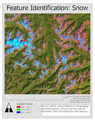
This week in GIS4035 we were introduced to spatial enhancement techniques, multispectral data, and band indices. First, we were tasked with downloading data through GLOVIS, which is surprisingly nice for a government website. After acquiring the data, we needed to preprocess it. In ERDAS Imagine we used a 3x3 low pass filter, a 3x3 high pass filter, and a 3x3 sharpen filter. In ArcGIS Pro, we experimented with other filters, such as focal stats mean and range. We also compared histogram manipulation techniques in both programs. Lastly, we experimented with multispectral bands to highlight or suppress features in the image.
ERDAS Imagine and Digital Data

Image
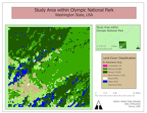
  This week in GIS4035, we were introduced to ERDAS Imagine. It seems to have a lot in common with ArcGIS Pro and I am sure I will learn a great deal about it in the coming weeks. The map we created depicts the different land cover classifications of a small area of raster imagery. My son is sitting on my lap as I write this. He asked why is it all blocks and, in a way, I think that question encapsulates this week's lesson. I explained to him, each block (pixel) represents a block just like Minecraft. Each block can only be one thing: dirt, rock, grass, etc. The more blocks you have, the more you can build. The higher the radiometric value, the more we can build!

Land Use/Land Cover Classification and Accuracy Assessment

Image
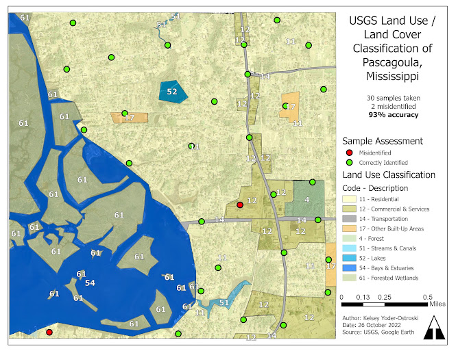
  A map depicting areas of land use/ land cover based  on USGS Level II classification system for the Pascagoula, MS area. This week for GIS4035, we were tasked with using aerial imagery to manually classify different areas of land use/land cover (LULC) based on the United States Geological Survey (USGS). Afterward, we had to assess the accuracy of our analysis by creating 30 sample points that were cross-referenced with in situ data through Google Maps. Finally, we created a map document to demonstrate our results. For identifying features, I relayed a great deal of association. Most of the map extent is residential with recognizable single-home neighborhoods. Retail and other businesses tend to run along major roads and, of course, that great, big blue stuff is water. However, using this strategy also caused my two errors. The red point on the bottom west corner was actually a small cemetery located within a neighborhood. The second misidentification belongs to a very large ...

Visual Interpretation

Image
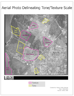
  Two maps created during Module 1 of GIS4035. Each one depicts different attributes when visually interpreting aerial photos. For this week in GIS4035, we were introduced to the basic concepts of visually identifying features in a vertical photograph. The shared language of visual analysis was emphasized. As visual creatures, we automatically "know" that an object is a tree or a forest, but as analysts, it is important to have a vocabulary to accurately describe and categorize objects and phenomena.