Georeferencing, Editing, & 3D
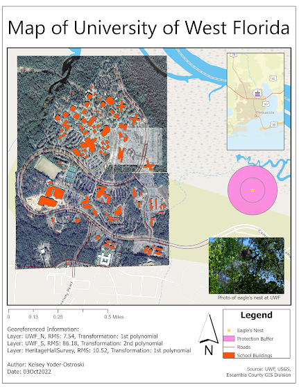
A map depicting the location of a protected eagle's nest located on the University of West Florida campus.
This week in GIS5050, we were tasked with creating a new map with combined, georeferenced raster and LIDAR images. Afterward, we were also asked to make our map 3D. We learned to georeference raster files by creating control points onto a topologically correct map, looking for familiar landmarks, and analyzing RSM errors for poorly marked control points. It was satisfying watching the raster become more accurate as each control point was added.
We experimented with editing tools by adding a new building and road to the campus. Let's say I have a new respect for the process of creating accurate polygons. Who knew drawing "simple" shapes could be so hard!
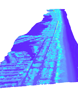
After creating a multi-ring buffer for our EagleNest point, we were finally instructed with creating a 3D version of our map. We combined our georeferenced raster with a LIDAR file, creating a new "ground" for our features to drape over. Lastly, we made the buildings "pop" by making them 3D as well. I would love to see how to process would appear on a more mountainous landscape.
Horizontally placed map product with elements moved off the map frame.


Comments
Post a Comment