Volunteered Geographic Information
For our last lab, we learned about the fairly new phenomenon of VGI or "volunteered geographic information", which is the generating of new geospatial information via untraditional sources. VGI commonly goes hand in hand with crowdsourcing, geotagging, and big data.
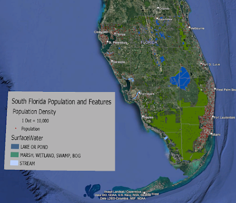
Popular tools for GIS are Google Maps and Google Earth. For this week's lab, we explored using Google Earth by creating our own map and 3D tour. We first created a traditional map in ArcGIS, exported the layer as a KMZ, added additional points of interest, and saved the file as a KML. With this shared data language, information can be shared between major GIS programs.
I'm not personally a fan of Google Earth's "flyby" mode as it reminds me of the early days of computer games. As a consumer of GIS, I prefer Google's Streetview or user-uploaded photography. I feel these better reflect how I experience the world as a human; I don't fly through the world like a drone but walk on the ground.
However, the importance of VGI can not be understated or dismissed. Not only does fill gaps in funding and interest that traditional organizations have largely ignored, it democratizes science and provides a platform for the marginalized. It has become ubiquitous and unavoidable.


Comments
Post a Comment