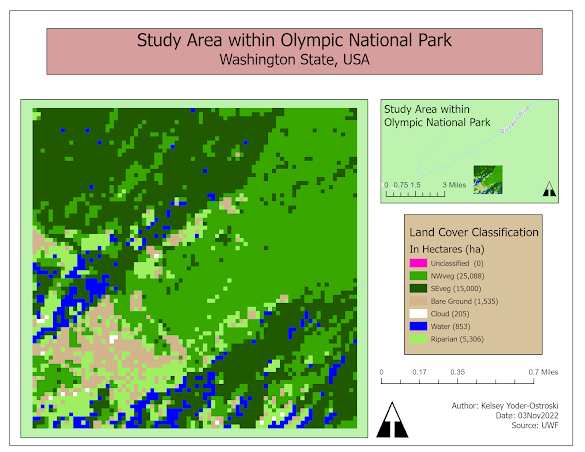
LiDAR and Vegetation Density
LiDAR (Light Detecting And Ranging) is an exciting method of remote sensing where light in the form of a pulsing laser is emitted and measured to create highly detailed images. LiDAR is capable of penetrating through vegetation (or water) and measuring topography, including manmade structures. It is currently the most accurate method of creating digital elevation models (DEM). With LiDAR collected from USGS, we were able to create a DEM and a digital surface model (DSM), the latter containing manmade structures in addition to elevation.


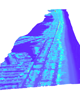
Density can be calculated by comparing the number of vegetation points to the total ground points. Here we can see red areas indicating human activity such as the campground and surrounding roads. The tallest canopy is represented with dark blue. Mapping forest density is vital to monitoring ecological health. Changes point to possible natural or manmade disasters such as illegal logging, disease, flooding, or drought.

Comments
Post a Comment