Coastal Flooding & Storm Surge Analysis
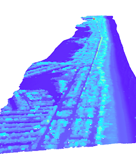
As climate change continues to intensify storms and increase flooding, it is vital for communities and governments to prepare for inevitable storm damage. In this week's lab, we explored coastal flooding models and prepared our own storm surge analysis. Our study area was Mantoloking, New Jersey, a low-laying barrier island that suffered major damage from superstorm Sandy in 2012. More information about the storm can be found on New Jersey's Department of Environmental Protection . Superstorm Sandy By comparing LiDAR data before and a few days after the storm, we can create a comparison analysis. The LiDAR data is converted into a DEM by first creating a TIN (triangulated irregulated network). As the TIN shows, the topography varies little with only very mild sloping. LiDAR .las point cloud dataset is converted into a TIN By subtracting the two DEMS, we can see the changes in the environment. Further color manipulat...


Comments
Post a Comment